Markings of Caminhos de Santiago and short-distance hiking trails coinciding with Rota Vicentina
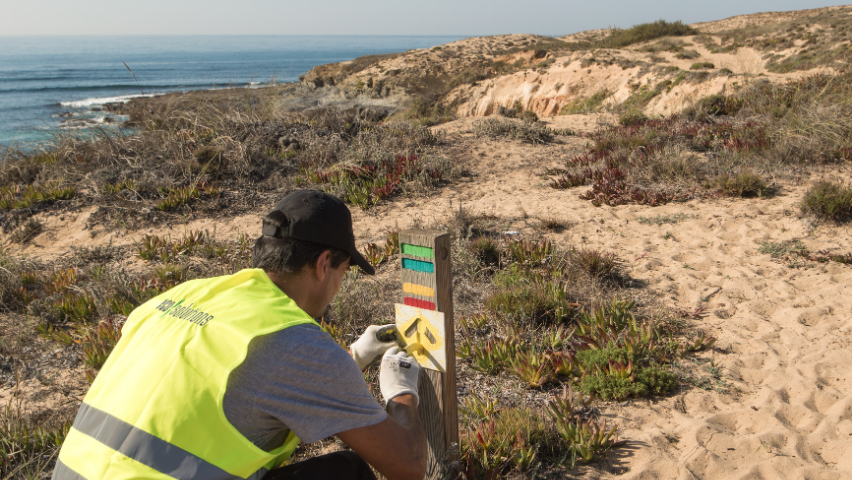
3 reading timeHey hikers! There's a variety of trails (and signage) in Porto Covo and Cercal do Alentejo areas.
As we are aware, the Southwest of Portugal has become an increasingly popular destination for hikers from all corners of the world!
In line with this trend, the number of Walking and Cycling Trails has been growing, not only promoted by Rota Vicentina. There’s already some trail overlap in certain areas. Let’s clarify!
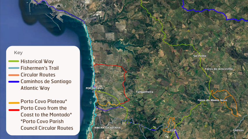
Caminhos de Santiago - Central Way via the Atlantic
In recent months, a variation of the Caminho de Santiago, the Central Way via Atlantic, has been marked.
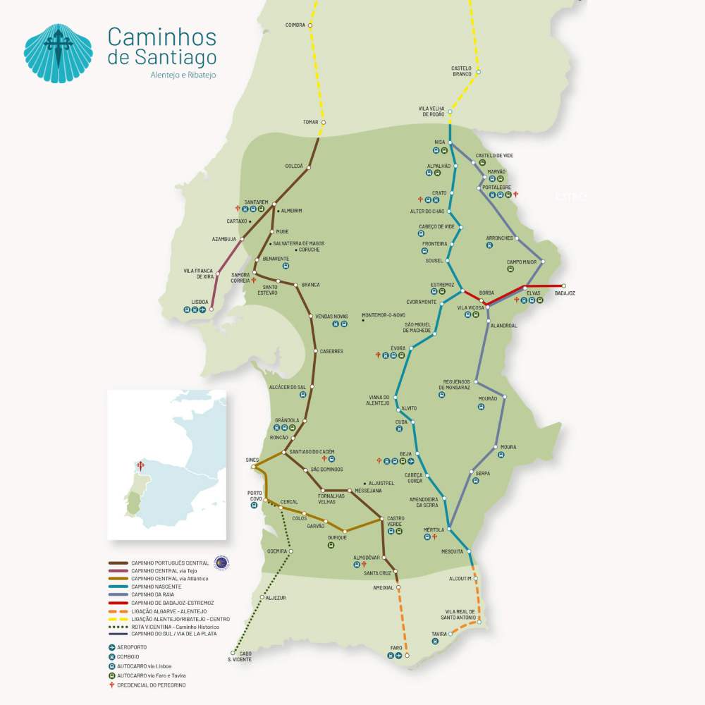
The Central Way via Atlantic partially coincides with the Walking Trails of Rota Vicentina:
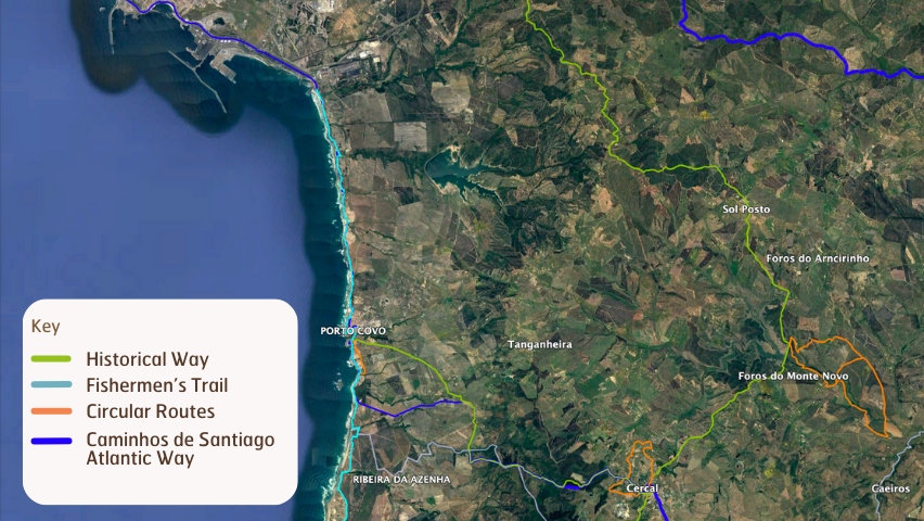
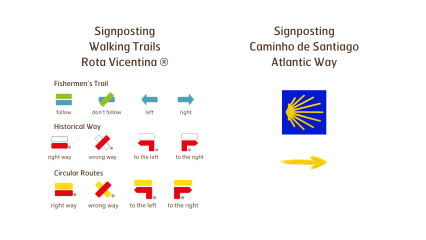
Historical Way
Cercal do Alentejo » Porto Covo section, between Cercal do Alentejo and the Fonte do Mouro area.
Fishermen’s Trail
S. Torpes » Porto Covo and Porto Covo » Vila Nova de Milfontes se, especifically between Pessegueiro Island and the S. Torpes beach.
Circular Route Sissal Beach
Between Porto Covo and Sissal Beach.
This Caminho de Santiago marking only exists in the south » north direction.
Signage of the Caminho de Santiago in Alentejo
Along the way, you will find the symbol of the Caminho de Santiago: a stylized yellow scallop shell on a blue background.
This signage does not indicate any direction. It becomes directional only when combined with a yellow arrow.
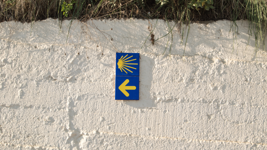
The yellow arrow indicates the direction and can be painted on rocks, trees, walls, posts, or even on the ground. In urban areas, it may also appear on specific tiles.
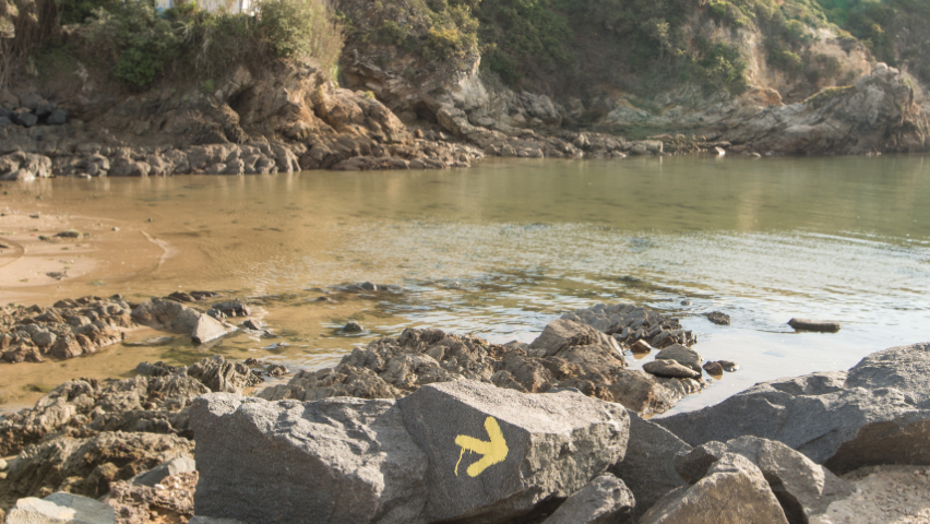
Often, Rota Vicentina’s trail pools are used for marking this other route. If you are following Rota Vicentina trail, always pay attention to Rota Vicentina’s signage to avoid taking the wrong turn at intersections.
Short-distance hiking trails in Porto Covo
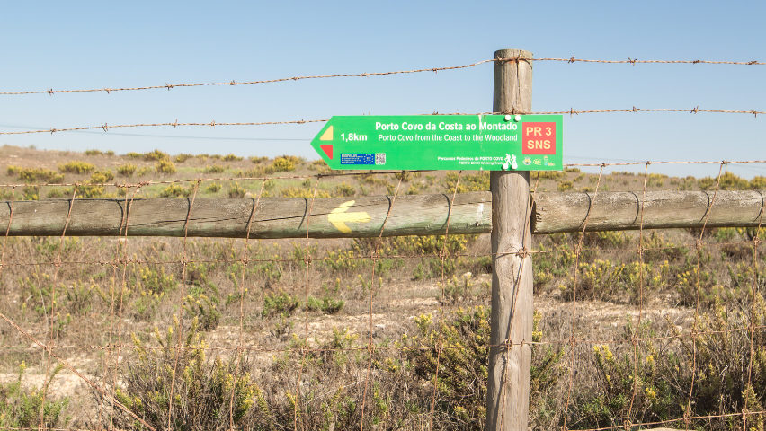
There is also a new offering of walking trails promoted by Porto Covo Parish Council: two Short-distance hiking trails – Planalto de Porto Covo (10.4 km) and Porto Covo from the Coast to Montado (22.4 km).
The signage for these trails is red and yellow, just like the signage of the Circular Routes of Rota Vicentina, with the starting point (and information board) located at Porto Covo Parish Council.
Regardless of the trail you choose to follow, make sure to prepare your hike in advance.
Confirm on the map which trail you will be taking, study the signage, understand the trail’s characteristics, and gather the necessary equipment (in the case of Rota Vicentina trails: Map and Guide Book). You can also download the GPS track.
Enjoy your hike!
Irene Nunes was born in France, in 1986. She graduated in International Relations, but it was in Ecotourism and Environmental Education that she found her path. Various experiences in tourism, nature, and culture inspired her journey and brought her to the Southwest of Portugal. Since 2017, she has been responsible for the Walking Trails and […]
Our suggestions
Search by category
